Keraunomania

Storm Chase 2021
Keraunomania
Keraunós: from Ancient Greek, thunder and lightning.
Mania: an excessively intense enthusiasm, interest or desire. An abnormal obsession with thunder and lightning.
⚡️ ⚡️ ⚡️
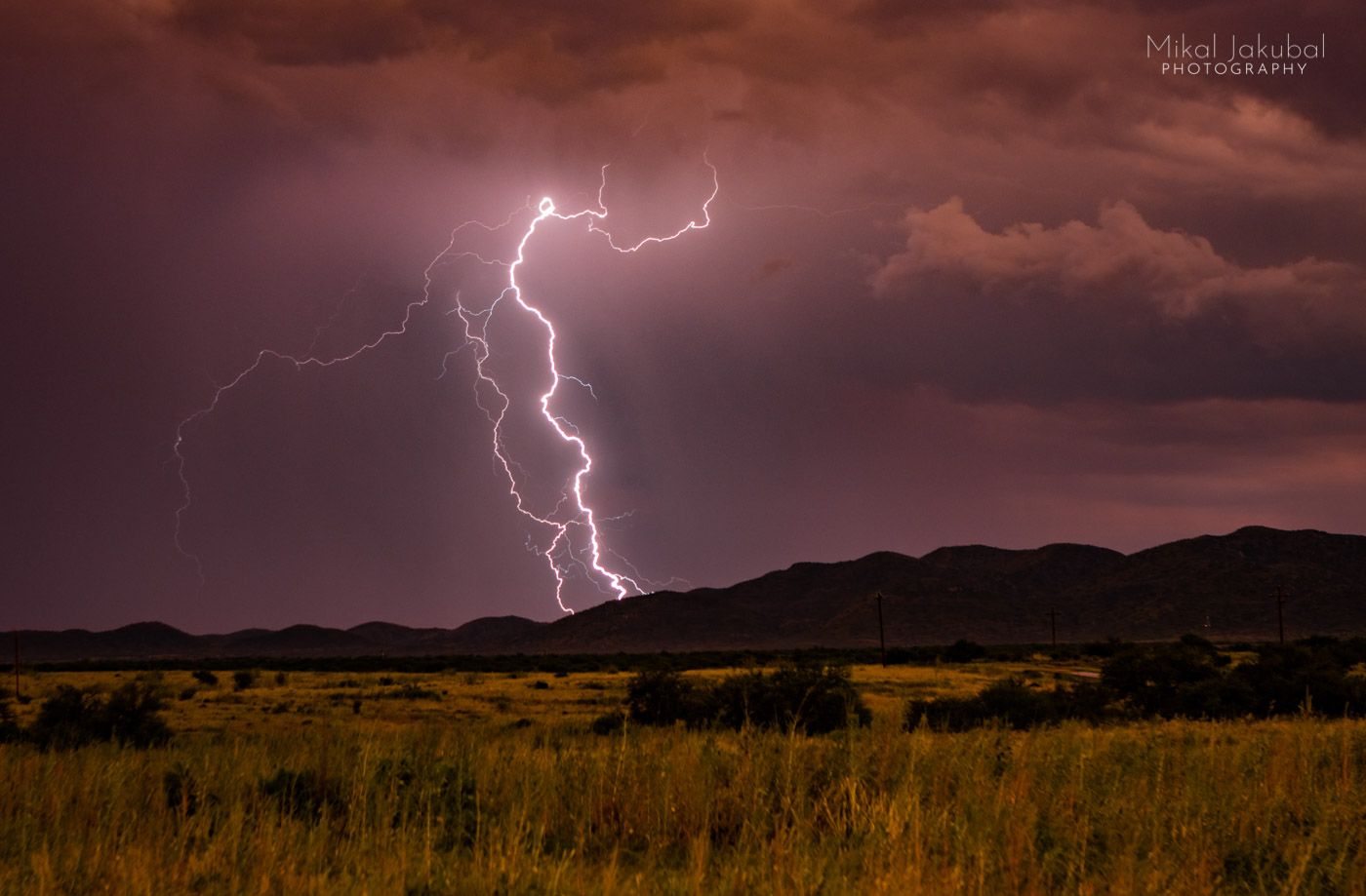
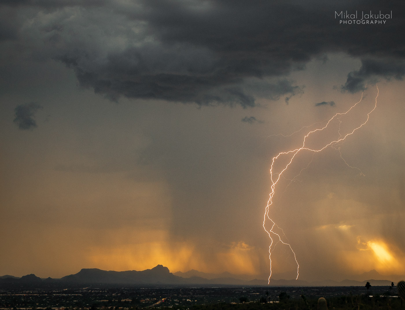
Ajo, AZ August 30
1 a.m.
I feel like a key on a 1,000 mile asphalt kite-string, pulled aloft on a mad quest to catch lightning in a jar. It will be my first monsoon chase season, a pilgrimage of sorts to the U.S. Southwest, the holy land of thunderstorm photography. Fifteen miles from what will be my home base for a month, road weariness is getting the best of me. My legs are cramping. Sleep whispers seductively in my ear. The caffeine wore off one state line ago.
Out over the eastern horizon, the tension between sky and earth is released in millisecond bursts, illuminating the contours of dark clouds and the skylines of darker mountains. The heavens are taunting like a striptease, lots of flash but the bolts are kept hidden. The longing is maddening. This is what I came for, but pursuit would mean a long detour. It is late. There will be other nights, other days, other roads and other storms. Continuing on into the night, the storm veers closer to my southward beeline on Hwy 85. Then at once the last coverings fall away and the bolts now cut naked orange slashes in the sky, baring it all above the familiar silhouette of Hat Mountain.
A wide turnout appears. I’m too tired to even think about stopping. Oh, hell. Maybe I’m not too tired? Ugh. Fuck it! Brake and swerve! An observer might wonder what the swearing was about as I fumble clumsily with tripods and cameras, still packed for the trip in the back of the truck. Check batteries, fiddle with settings, push the button and it’s Game On! Storm Chase 2021!
⚡️ ⚡️ ⚡️
I’ll spend the next month driving like a fugitive across the state, sleeping in my truck, being sleepless in my truck, staying out late and getting up early, staring at clouds, staring at apps, staring at computers. I’ll be by turns elated and frustrated, exhausted and exultant, hopeful and deflated, clever and clumsy and frequently wondering wtf I’m trying to accomplish. The truck’s stiff suspension and endless driving on bumpy roads will reactivate previous, devious and very painful sciatica. Chase now, pay later. It will be all worth it in the end, somehow.
⚡️ ⚡️ ⚡️
One curious thing I learned on this, my first monsoon chase season, is that despite National Weather Service reports of clear skies and 0% chance of rain, with the right conditions a storm cell can form out of thin air, drop mad bolts and then vanish. The only way to catch these is to watch the sky, watch the radar and be quick on the draw. And lucky.
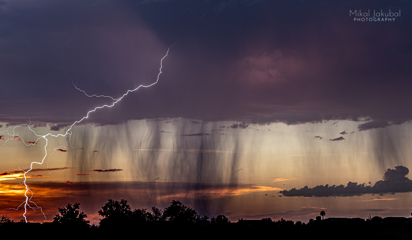
Phoenix, late afternoon
I-10 westbound
On this “0%” chance of precipitation day, a precocious little cloud is trying really hard to be a big deal, like an 18 year old trying to look 28 to match their fake ID as the bouncer gives them the side-eye. Pulling off on three consecutive exits looking for a clear view, I’m foiled again and again by electrical wires slitting the sky like a bread slicer. Back in the ‘80s, an FBI provocateur goaded some radical environmentalists into cutting down powerlines not far from here. Cleaning up the view for storm photography was not their motivation, but they have my deepest sympathies at this moment.
There is a huge gravel pullout right where Highway 85 heads south, with a view finally devoid of the Wires of Satan. I’m tired and want to get home before dark, but the adorable little stormlet is like a puppy demanding to be played with. Who can resist a puppy? I’m barely set up when, “zap!” a cute little bolt adds a nice accent to the sunset colors. Minutes later, the cloud dissipates.

⚡️ ⚡️ ⚡️
I return home empty-handed many days. Sometimes the lightning strikes where I’d been an hour before or strikes an hour ahead of me or strikes on the other side of the mountains or other side of the state. Sometimes it just doesn’t strike. But a fruitless chase only intensifies the thirst for the next one. A fruitful chase, even more so. Either way, being out in the wild weather and raw elements pursuing phantoms is its own reward.
⚡️ ⚡️ ⚡️
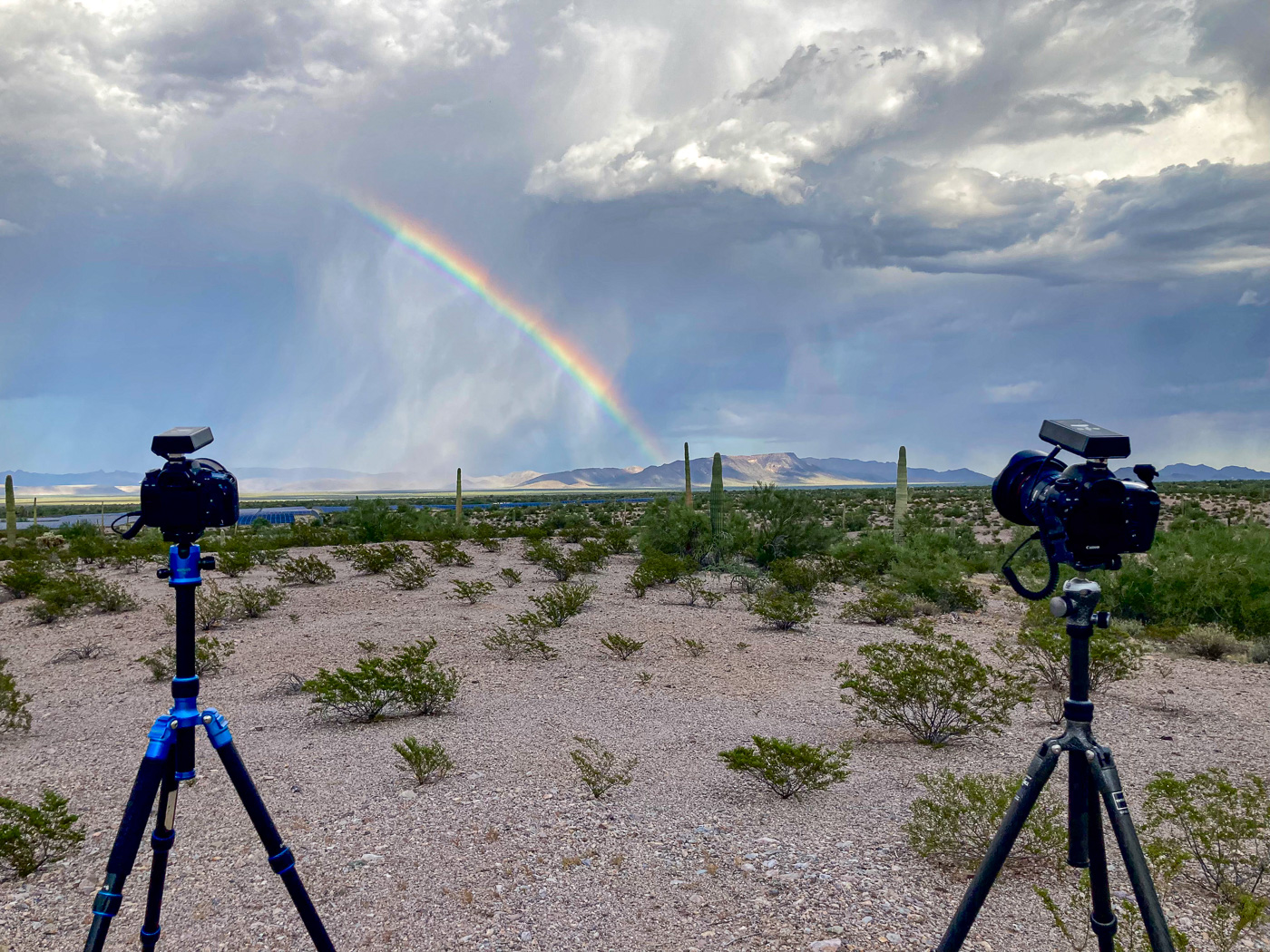
I remember when I first saw lightning photos and decided I wanted to learn how to catch bolts myself. I also remember how cool it was when I finally got one! Now I’ve begun to pursue more exotic quarry, particularly rainbows and lightning together. This has proven maddeningly elusive.
The lightning and rainbow pot-o’-gold shot is based on a simple geometry: a rainbow will appear in front of you when you’re looking away from the sun and toward suspended moisture. To get a “rainbolt” shot, position yourself between the storm and sun and wait. Maybe for a very long time, as it turns out.
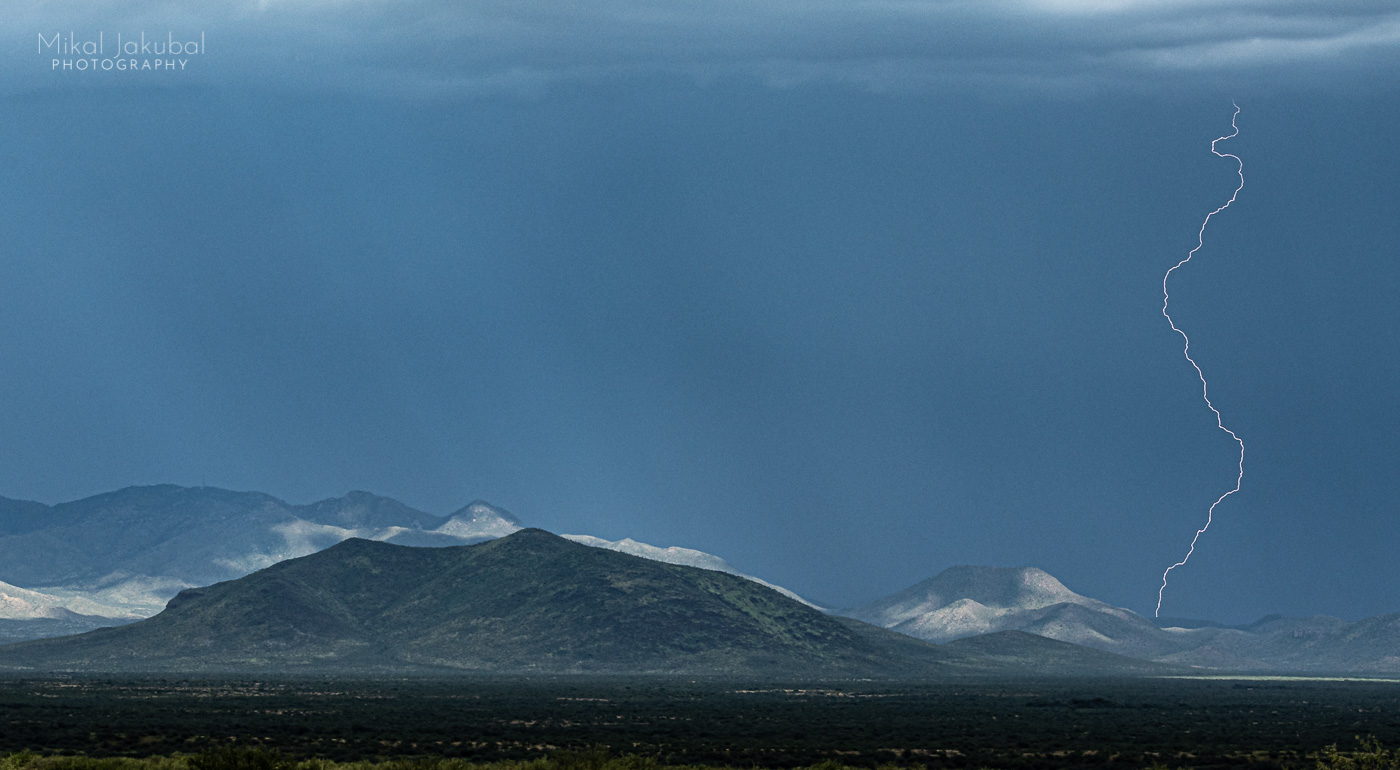
Pipeline Road, Ajo, AZ
I’ve got a nice clean view perpendicular to and west of the storm track, looking across a creosote flat toward the Sikort Chuapo Mountains. Frustratingly, most of the electricity is discharging north of the Batamote Mountains, before the southward moving cells come into my field of view.
The geometry aligns for a perfect late afternoon sun break and an apparition of a rainbow emerges from the mist. I’ve got two cameras set up with wide lenses, covering the whole scene with some overlap. The rainbow brightens. Come on! One little bolt! Who do I have to bribe to get some service around here?
Now radar is showing significant strikes to the southwest, out of sight behind a mountainous mine tailings pile. I can hear the thunder loud and clear. It is tempting to pack up and move, but I’m placing all my chips on this rainbow shot. The colors brighten, then fade. It feels like watching a roulette ball slow down and bounce into a slot just past my lucky number. The last storm cell fizzles out. I return home with a consolation rainbow.

⚡️ ⚡️ ⚡️
One advantage of an obsession is that all the gear is always packed and ready to roll. This morning’s Grand Canyon weather forecast calls for 40% chance of thunderstorms, starting in a few hours. Minutes after reading the weather report I’m on the road to the South Rim, five hours away.
Moran Point Overlook, Grand Canyon
At Flagstaff I make a decision to head to the South Rim main entrance instead of going east and through Cameron. I think I’ll have a better chance flanking the line of storms and getting into position quickly from this side. I haven’t been to the South Rim in over 30 years, so have to make my best prediction and act on it quickly, based on the storm track, lighting, time of day, topo maps, best viewsheds and where the roads are.
Moran Point turns out to be the perfect convergence of view, light and angle to the storm track. I have three cameras set up, two with triggers and one making a timelapse. As the afternoon wanes into dusk and the tourists all leave, the final storm of the day quietly follows them out. I come home with a short timelapse on an otherwise no-hitter day. That aside, I’ll never regret a day spent at Grand Canyon.
⚡️ ⚡️ ⚡️
When referring to storm chasing, I can’t say that “thrill of” goes with “chase” very often. Most of my chase time is spent in the truck, semi-frantically trying to get ahead of a storm and cursing slow drivers, locked gates and view-polluting powerlines. Then more driving when the radar shows all the strikes hitting over there, which is to say, anywhere but where I am. I’ve come to think that it should be called storm driving, but that doesn’t sound nearly so romantic or adventurous, never mind thrilling.

I’ve come to recognize that I habitually carry a measure of self doubt, like an invisible backpack of deadweight, into everything I do. In the zone, the straps slide from my shoulders without friction or effort. In that moment when the shutter and the flash of lightning are in perfect sync, I’m no longer concerned if I’m good enough. I know “I got it!” There will be time for critique later. In the undiluted thrall of otherworldly landscapes and electric skies, I’m here and the world is perfect, no matter how the pictures come out. In the zone, the weight of the world evaporates like virga over a dry plain. I think we’re all chasing our own storms and looking for the zone in some way. For now, this is my way.

⚡️ ⚡️ ⚡️
I got wind through the online chaser community that there was a rare chance of a thunderstorm over Death Valley tomorrow morning, a mere 11 hours away. Grand Canyon lightning should be sure bet with this storm, so it makes much more sense to go there, right? Who would trade an 11 hour drive and such slim odds for an easy catch at Grand Canyon? That’s nuts.
Dante’s View, Death Valley National Park.
Dawn
I didn’t sleep enough. My back hurts. I don’t care. A steady line of storm cells is sweeping up the far side of the valley from the south, their gauzy rain skirts trailing as if gently snagged on the stark, stony landscape as they pass. The light is amazing. The framing is perfect. Now for one little bolt. Yep. Now would be the time. Sure would.
Oh! A little dawn rainbow! Yes, this would be a perfect time for one wee little strike. Just. One. After 11 hours of driving, is that too much to ask? IS THAT TOO MUCH TO ASK?
Reader, it was too much to ask. But, like Grand Canyon, Death Valley is perfect and complete unto itself, empty data card notwithstanding.

⚡️ ⚡️ ⚡️
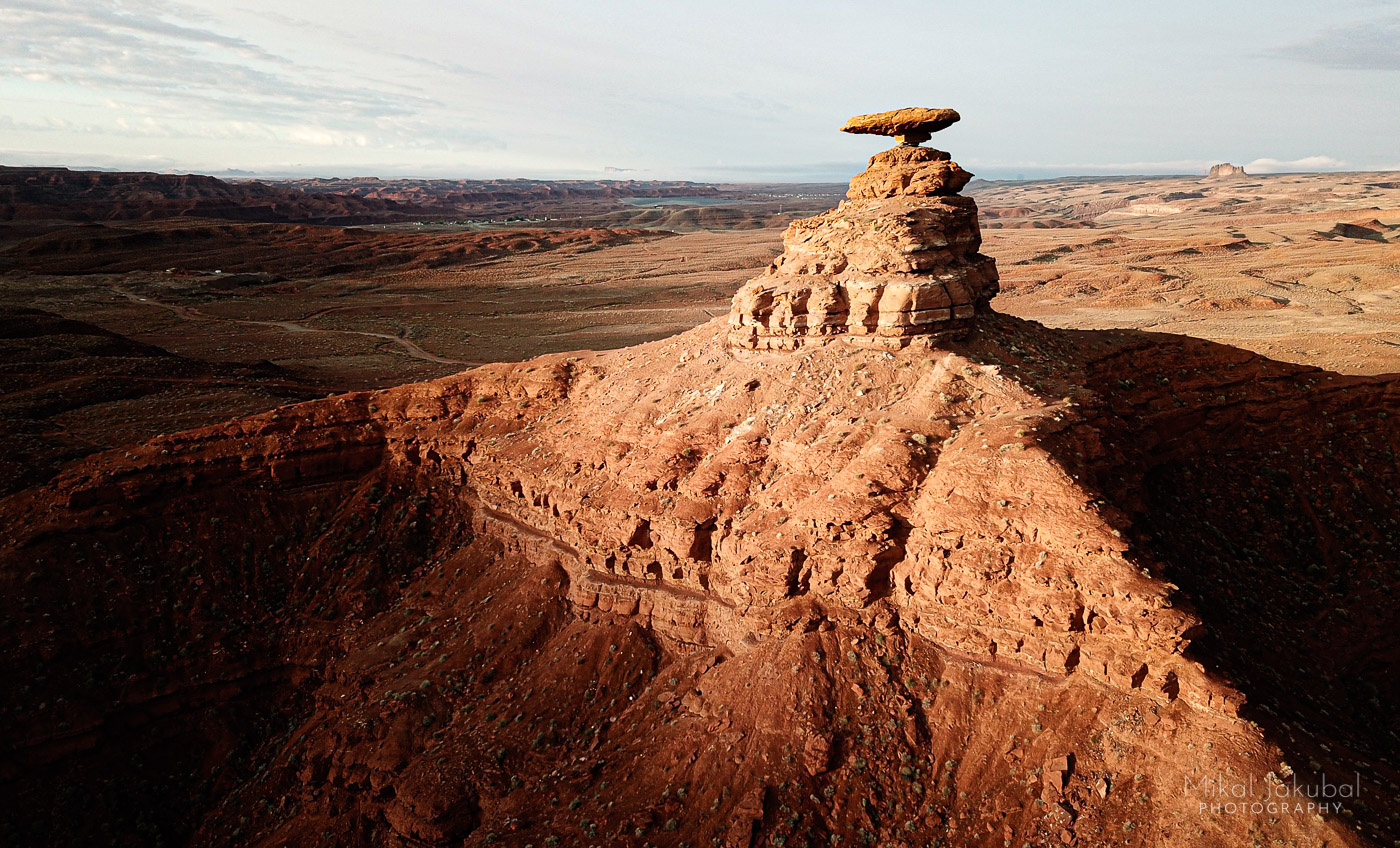
Monument Valley, AZ
I’ve been driving all day behind the fronts or in front of the fronts or next to the fronts since I left Death Valley this morning and blasted eastward across the Arizona Strip toward Monument Valley in the hopes that the 40% chance of thunderstorms predicted for this afternoon would give me what Death Valley couldn’t. An hour out of Kayenta I see a bolt hit a nearby ridge, the only strike I’ll see on this three-day, 1500 mile trip. But waking up under Mexican Hat Rock and bathing in the San Juan River tomorrow after a boltless sunset at Monument Valley tonight will make a nice ending to this adventure. Well, not the end. There is the post-chase 400 mile drive home. With no lightning in the can, it’s like nursing a hangover from a party that no one else showed up for.

⚡️ ⚡️ ⚡️
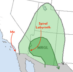
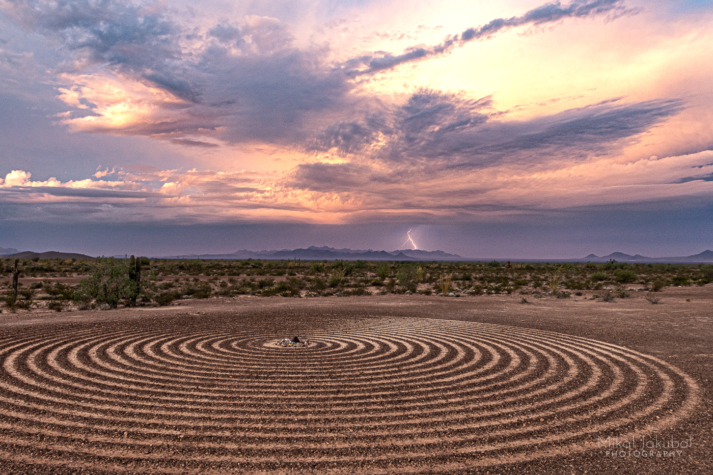
Spiral Labyrinth, Kofa National Wildlife Refuge, AZ
October 2, noon
I’m headed back to NorCal for a while. The monsoon season in the desert is over. I’m fighting off regret at not getting out sooner in the season, trying to keep in mind that this has been an awesome adventure nonetheless. Still, I’m jonesing for another storm or two. Next July’s monsoon season seems so far away.
I’m taking my time, driving new-to-me backroads both for the scenery and to scout future chasing areas. I have a “chase map” that I have created to note good vistas, compass directions and interesting foregrounds. Off of Hwy 95 between Yuma and Quartzsite, down a dirt road on the boundary of Kofa National Wildlife Refuge, someone has constructed a 60 foot diameter spiral labyrinth by scraping the dark, weathered surface stones (called desert pavement) into a low spiral ridge, exposing the lighter colored soil below it. At the labyrinth’s entrance, I forego walking the entire spiral and make my way straight across to look at the eclectic pile of offerings left by prior visitors. Hopefully I didn’t jinx myself. Luckily, I’m not superstitious.

I mark this spot on my chase map, thinking “this would make a badass foreground for a lightning shot someday” and continue the long, tedious trek toward Northern California.
⚡️ ⚡️ ⚡️
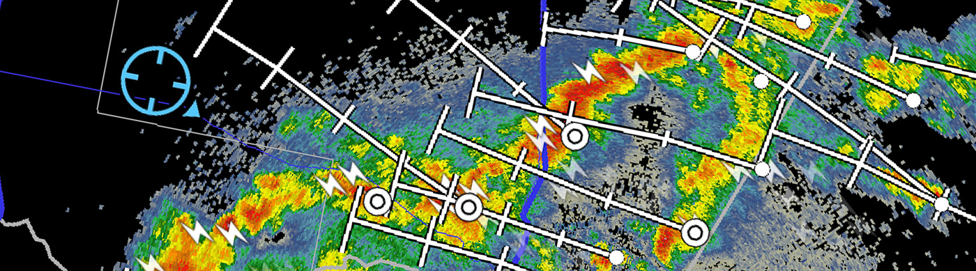
Knowing where you’re going and where the good views are is a big part of getting good storm shots. When in unfamiliar areas, I rely heavily on paper maps because they allow for the simultaneous view of the small backroads and the 30,000-foot view of how it all fits together on a landscape scale, something mobile apps cannot do. I also use satellite imagery to find areas free of vegetation and powerlines. Topo maps help to locate high spots with good views. I check online to find sun’s azimuth at dusk when I’m shooting for a rainbow/lightning alignment. All this helps to build a three-dimensional mental model of the terrain, road access, lighting and nice foreground vistas so that when the storm cells show up on radar, I can make a fairly educated guess about best locations and how to get there. I’m new to chasing, but reading and navigating landscapes is my jam.
I’m very much a newbie and the learning curve has been steep. I use one main app, RadarScope for watching storms develop on doppler radar, though to be honest I barely understand most of the setting options. I occasionally use Lightning app’s alarm function to alert me when bolts hit within a set distance. I also consult NOAA Storm Prediction Center’s (SPC) Convective Outlook webpage and read the mesoscale discussions when posted. There is also a very active storm chase Twitter where the pro chasers share their best guesses on where shit’s going down and the best places to be to catch it.
ProTip: do not check storm chase Twitter when you have places to go and things to do.
Stopping for a break on the drive back north, I check storm chase Twitter and see there’s a warning about a big lightning storm aiming at San Diego day after tomorrow. Wait, whaaaat? How did I miss this? But…but, I can’t go that way. I’m supposed to be way up in Northern California by tomorrow.
⚡️ ⚡️ ⚡️
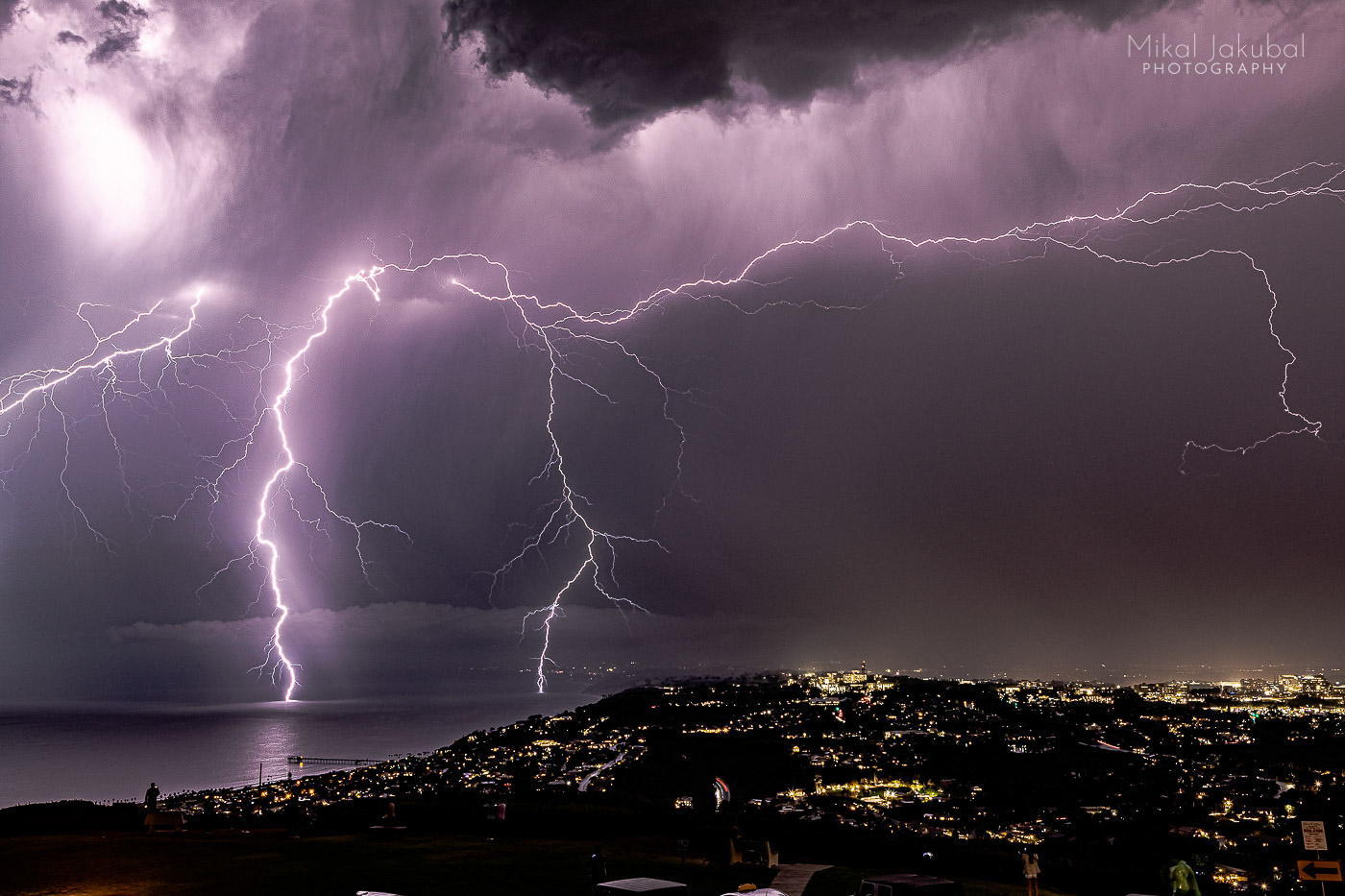
Mt. Soledad, La Jolla, CA
October 4, 5pm.
The strikes start to the south and then to the east, but the really big show doesn’t start till after dark, and then shit gets banger. Sick bolts are dropping left and right. Huge flames erupt after a strike ignites a grove of palm trees and spreads to structures in the city below. SoCal knows how to paaartay. The fire and smoke and the crowd cheering it on like Romans at the Coliseum give the whole scene an apocalyptic vibe. This is a better grand fucking finale to the season than I could have possibly wished for and I’m all here for it.
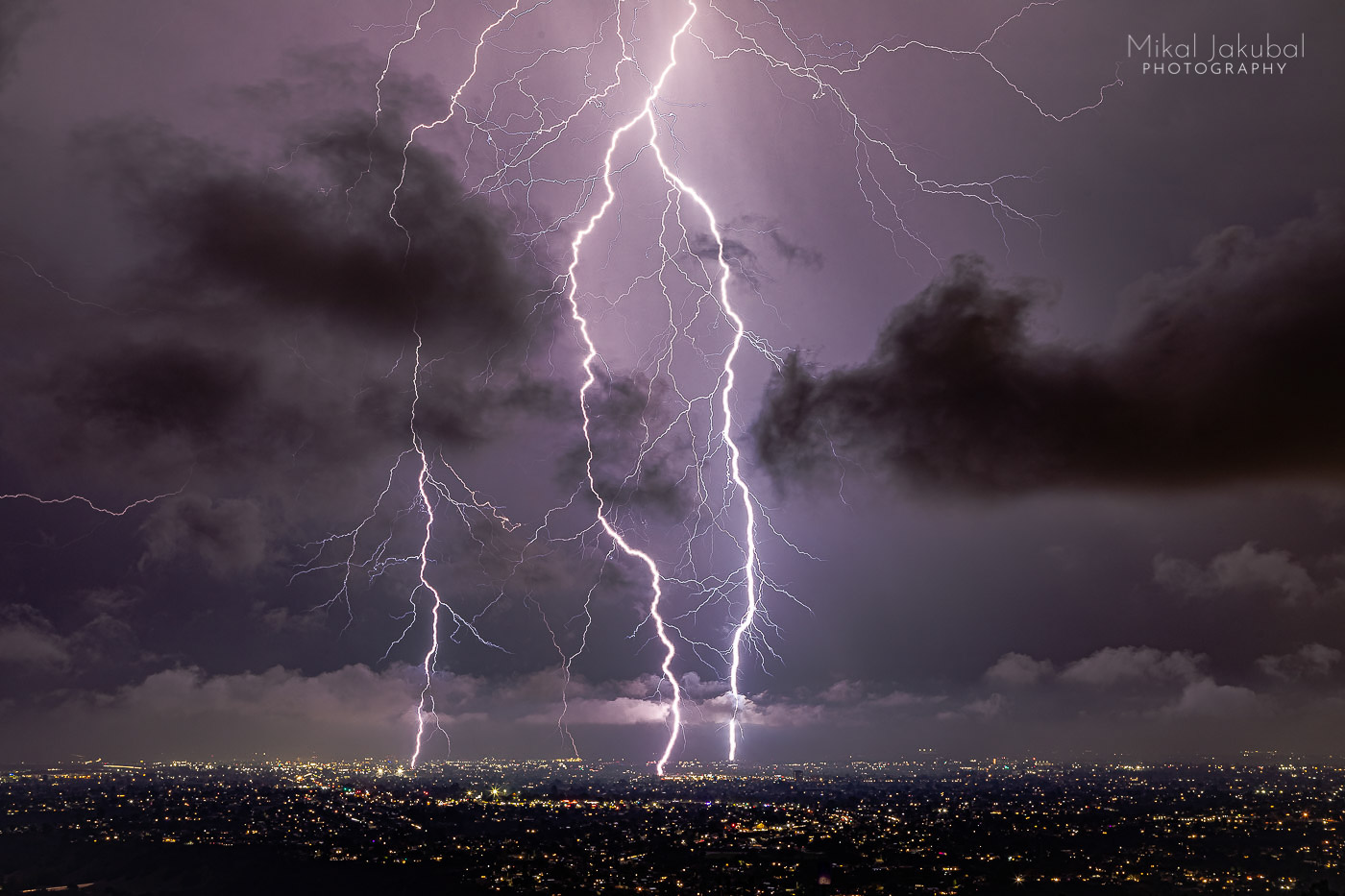
People on the hill here are whooping it up as the strikes come closer, apparently oblivious to the looming danger of becoming crispy critters if one of these mega bolts hits us. Several times people around me nervously joke about the fact that we are all on the highest point for miles in any direction, leaning against a metal fence. The image of a human bug zapper comes to mind.
😬 ⚡️ 😬

It’s easy to maintain a dysfunctional sense of denial when doing something dangerous if you’re surrounded by a large group of people also doing it, even if it seems they are all oblivious or drunk and not the best behavioral role models. “How dangerous could it be if everyone is doing it, right?” Since that sounds a little reckless when I say it out loud, I try reason: “Okay, yes, this is stupid,” I tell myself, “but there are at least a hundred people up here, so the chance that I will be the one to be struck is only, like, 1%, right?”

Finally, self preservation kicks in and I retreat to the truck and hide till the main front passes, then head back out for a few shots as it moves north toward L.A. Around 10 p.m. a blast of rain does what a healthy sense of self preservation couldn’t and everyone scampers to their cars and goes home alive.
It feels like I spent most of the evening wiping droplets off lenses, fiddling with gear, fiddling with settings, fiddling with lenses, moving the tripod only to have the bolts strike where I had been previously pointing, overexposing the big bolts, underexposing the smaller ones. For a while I was convinced that I’d missed every good shot. Luckily I was mistaken.
⚡️ ⚡️ ⚡️
Mt. Soledad
October 4th, 10:30 pm.
“Park’s closed!” says the cop, banging on my rain covered window where I’ve been sheltering in my truck editing photos.
Okay, fine, but where the hell do I go now? This sudden detour didn’t come with an onward ticket or an exit plan.
ProTip: never check the Storm Prediction Center’s convective outlook when it’s late at night and you’re exhausted and need to sleep and should have been heading north yesterday instead of chasing storms.
⚡️ ⚡️ ⚡️
A parking lot in La Jolla
October 4th, 11 pm.
Checking the just-now-updated SPC severe thunderstorm outlook shows that the area around the spiral labyrinth went “MRGL”. That’s pretty much a guarantee of thunderstorms. It’s a four hour drive to the east, the way I came from and the opposite way I need to be traveling.
Spiral labyrinth
October 5th, 3 a.m.
I’m shooting the spiral labyrinth by light painting it with my phone’s flashlight while bolts blip way off in the distance. None turn out very good, but after that epic drive, I need to have something to show for it. One camera is pointed back the way I came, timelapsing in the hope of catching sprites above the far-off storms.
Spiral labyrinth
6 a.m.
I’m still awake after a couple hours of unsuccessful attempts at sleeping in the passenger seat. The first strikes of the approaching system start popping in the distance. I hurriedly make coffee, but spill half of it while moving a tripod. I guess I should eat something? No time to cook and I’m out of snacks. How am I even still awake? How is this even possible? My back is fucking killing me. I can hear thunder! This place is amazing. OMG, look at that sunrise. Ugh, this better be worth it!
The bolts keep getting closer and more awesome. I’m waiting for a big, clear strike directly above the spiral. It’s what I came for and, man, the tension is fierce. The storm front is barreling straight toward my position, so I have to capture the first strikes before the wall of water arrives and the strikes get dangerously close. I’ve got one camera set up on the tailgate, partially sheltered from blowing drops by the canopy hatch raised overhead. I’m holding the umbrella like a lightning rod out for more protection from rain drops, though I still have to wipe the lens every minute or so. I got some great shots of lightning-obscured-by-hand-and-lens-cloth.
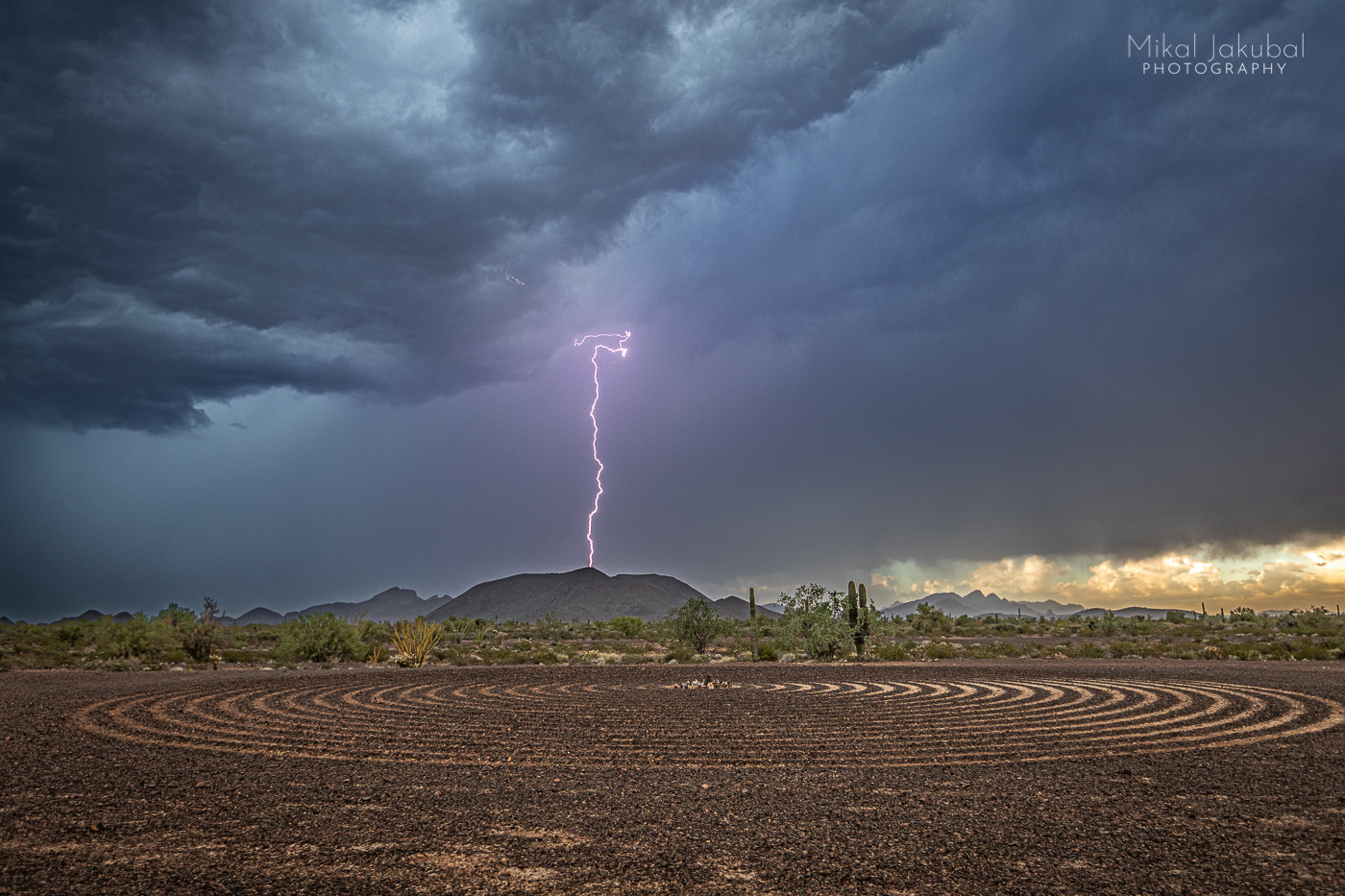
Then…SHAZAAAAM!! The simultaneous flash and boom of a very close strike tells me it is time to get the hell out of harm’s way. Moments later the downpour starts and it’s Game Over, 2021. Reviewing the shots in the truck cab’s relative safety, I am pleased. I can go home now.

As they say, “You miss 100 percent of the shots you don’t [drive hours through the night, fighting exhaustion and self doubt to] take.”
⚡️ ⚡️ ⚡️
Berkeley
October 5th, 10 p.m.
Rolling into a friend’s driveway in Berkeley, my body feels like it has metabolized more caffeine than the truck has burned gas in the twelve hours since I left the labyrinth and the desert, the spiny cactus and sharp rocks, the smell of creosote bush and petrichor, the crack of thunder and flash of lightning, the wide sky and the zone. I’ve only had a few short naps in over forty hours. Am I really even awake? What day is this? My back hurts. What just happened? Lighting. Thunder. Mania.
⚡️ ⚡️ ⚡️
Late December note: I have caught up on sleep, the sciatic pain has abated and I’ve switched to decaf.
Never don’t chase.